Koroni Maps
12.08.2025 - New: Akritas Map (Island50)
Cape Akritas - Venetiko - Egg Island
07.08.2025 - Map Release V4 2025 Completed
Topo25 with cartographical improvements
01.08.2025 - New Overview Map
Pylos-Nestoros
25.07.2025 - New Overview Maps
Messinia, Peloponnese, Greece, Europe
29.05.2025 - Koroni Maps - All Maps Updated 2021 > 2025
Big new Release: Surroundings Map - New City Map Akritochori
13.05.2025: Koroni Topo25, Koroni City 10S and Koroni Kastro Map UPDATED
=> EDITION 2025 now DIGITAL available
14.04.2021: Update of all maps on same actuality
18.02.2021: New City Maps: Charokopio, Chrisokellaria, Vounaria, Agia Triada
09.02.2021: Vasilitsi City Map is available digitally
04.02.2021: Koroni Surroundings Map update: edition 2021 available
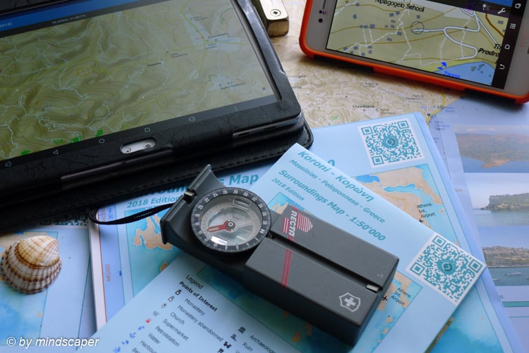
Detailed, Topographic, A Must Have
Discover Koroni and Surroundings by using Koroni Maps made for Koroni Meet. The maps are the best way to discover Koroni & Surroundings for your own.- The maps are available printed or digital for mobile devices () for offline use.
- The digital maps are designed for offline usage and has various functions like showing your GPS Position, GPS tracking, adding Points of Interests & geotagged Photos.
- Topographic Maps.
- City Maps.
- Detail (Sights) Maps.
- Administrational Maps.
- Overview Maps.
see further Overview Maps (Koroni Map Series)
What Maps are Available
- Koroni Surrounding Maps 1:25’000 (digital) or 1:50’000 (printed)
- Koroni City Map 1:10’000
- Kastro Map 1:2’500
- City Maps of Villages and Hamlets
- Akritas Map 1:50’000
- Overview Maps (Messinia, Peloponnese, Greece, Europe)
- Administrational Maps (geoadministrational reforms)

Featured Maps


Why Koroni Maps
What do you know about Koroni and it Surroundings? In which area do you stay and what can you explore?
Discover the beauty of Koroni and special places of Koroni surroundings and the outback with the detaild documentation collected in the Koroni Surrounding Maps.
The maps are independent and more detailed of other printed or online maps from Google, Bing, Apple or Here … .


Available Maps


General Map Infos
- ideal for Koronians, tourists, holiday guests, house holders, mountain bikers, hikers, map lovers
- all Points of Interest (POI) approved
- made by a professional knowing this area since more than 45 years
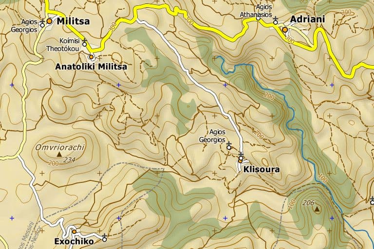
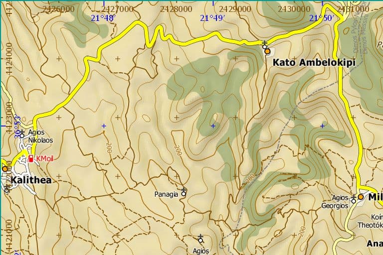
Koroni Surroundings Map
This is the Main Map
- extent: former Dimos Koroni
- E-W: Koroni – Finikounda
- N-S: Episkopi, Paneika – Venetiko Island

Mapextent Koroni Topo25 and Topo50
Find out more: Koroni Surroundings Map
Printed Maps


The printed Koroni Surrounding Maps are available at scale 1:25’000 and 1:50’000. On both, the citymap is also on the print.
Digital Maps


-
- digital version of printed maps for offline usage (no network or wifi required, no roaming) within Avenza Map App (Android or iOS (iPhone, iPad))
- map bundles
- single maps
- additional data for import to the maps
- addition of Poi’s from the map maker (pending)

App Features
- for Android or IOS with
 Avenza Maps App
 -
 visit Avenza to find out more about the App
 - find the app in the corresponding app store
(the app is free for recreational use)
App Functions
-
- You can use the purchased maps on more than one device
- the maps are raster (see the same content when zooming a single, but no search for objects in the map per se), but you can add addtional data
- Pan, Zoom
- Maps are georeferenced: App supports GPS and Compass of your mobile device –
you may locate your current position on the map) - You can Add Markers to the maps
- Take & Add Photos on the map
- You can track your path on the map (store and visualize)
- Measure Distances
- Measure Areas
- Import maps, tracks ond Pois
- Export Feature
- Buy Koroni Maps and others
- Building map Groups
- read about the app features at Avenza
Get the digital maps
Get them online or within the Map App:
- Stefanos Maps Corner (Map Maker) at Avenza
- Koroni Maps at Avenza Map Store (Alternate way to same conditions)
- at Avenza Map Store within the Avenza Maps App for Android or IOS
Some maps are free.
Koroni Maps Overview & History
| Map | Type | Size | Print !!! currently not available !!! | Digital | Digital Bundle [Topo25+ City10+Kastro] | Digital Bundle [City10+ Kastro] | Digital Bundle [Koroni Set All - Topo25 + Villages + City + Kastro] | Digital Bundle [Koroni Set - Village Maps] | Actuality |
|---|---|---|---|---|---|---|---|---|---|
| Koroni Surroundings Map 1:25'000 | Topo25 | A0 | Special | [Topo25] | X | X | August 2025 | ||
| Koroni Surroundings Map 1:50'000 | Topo50 | A2 | [Details] [request form] | . | April 2021 | ||||
| Koroni City 1:10'000 | City10 | on Topo25 or Topo50 | [City10S] | X | X | X | May 2025 | ||
| Koroni Kastro 1:2'500 | Kastro | A4 | - | [Kastro] | X | X | X | May 2025 | |
| Vasilitsi City 1:5'000 | City5S | - | [Vasilitsi City5S] | X | X | May 2025 | |||
| Vounaria City 1:10'000 | City10S | [Vounaria City10S] | X | X | May 2025 | ||||
| Chrisokellaria City 1:10'000 | City10S | [Chrisokellaria City10S] | X | X | May 2025 | ||||
| Charokopio City 1:10'000 | City10S | [Charokopio City10S] | X | X | May 2025 | ||||
| Agia Triada (Koroni) City 1:10'000 | City10S | [Agia Triada (Koroni) City10S] | X | X | May 2025 | ||||
| Akritochori City 1:10'000 | City10S | [Akritochori City10S] | X | X | May 2025 NEW |
||||
| Akritas 1:50'000 | Island50 | [Akritas (Island50)] | May 2025 NEW |
Get in Contact
Koroni Photo Maps


last revised: 26. March 2026
published: 06. June 2018